Hunting on Public Land: The Complete Guide
How to find, access, and hunt public land effectively — BLM, National Forest, state land, walk-in areas, and tactics to escape the crowds and find game on land anyone can hunt.
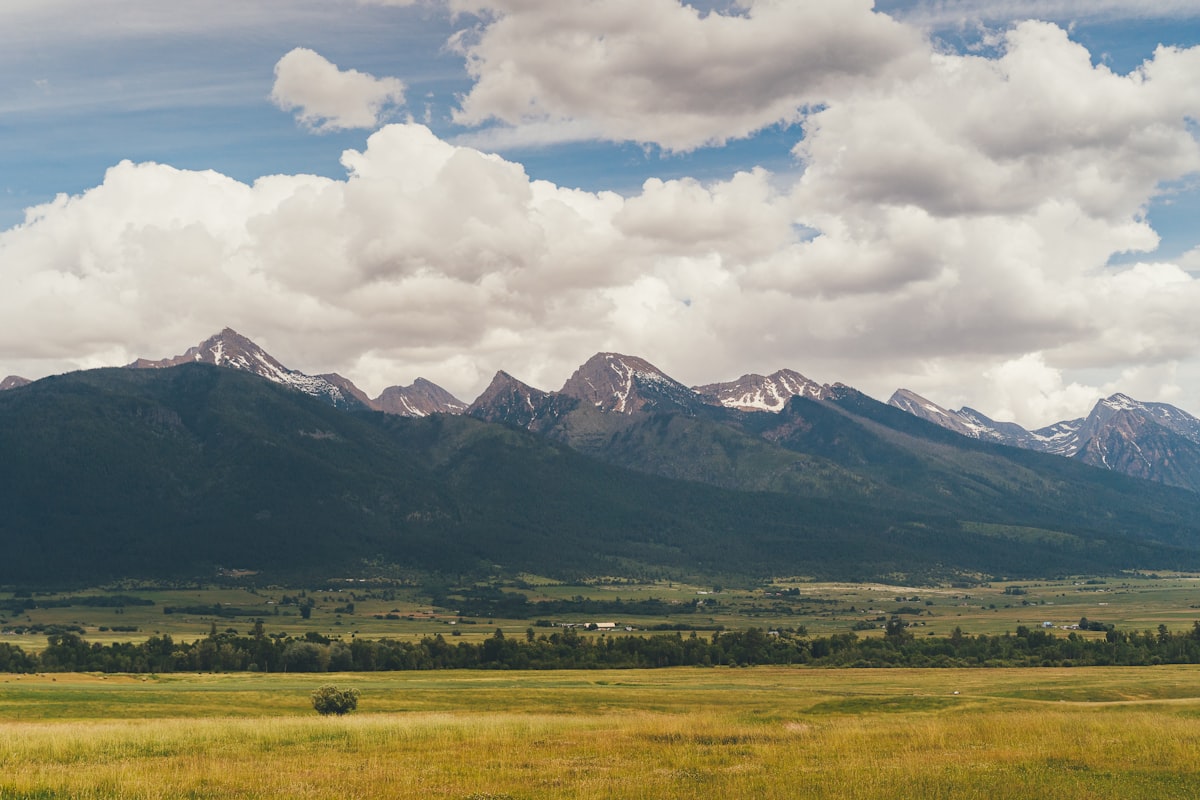
Public land is the backbone of hunting in America. Over 640 million acres of federally managed land — Bureau of Land Management, National Forest, National Grasslands, Wilderness Areas, and Wildlife Refuges — plus hundreds of millions more in state trust lands, state wildlife areas, and walk-in access programs. Every licensed hunter in the country has the legal right to hunt this ground.
But legal access and productive hunting are two different things. The trailhead parking lot full of trucks on opening morning tells you everything about the challenge: public land is available to everyone, which means the easy-access spots get hammered. The hunters who consistently fill tags on public land do things differently — they go deeper, they scout harder, they understand land ownership patterns, and they hunt when and where other hunters won’t.
This article contains affiliate links. We may earn a small commission if you purchase through these links, at no extra cost to you.
This guide covers how to find public land, how to access it legally, and the tactics that separate the hunters who tag out from those who just go for a walk in the woods. Whether you’re planning a DIY western elk hunt or hunting whitetails on your state’s walk-in program, these principles apply everywhere.
Types of Public Hunting Land
Not all public land is created equal. Understanding the different land management agencies, their regulations, and their hunting allowances is the first step.
| Land Type | Managing Agency | Approx. Acres | Hunting Allowed? | Key Notes |
|---|---|---|---|---|
| National Forest | USDA Forest Service | 193 million | Yes (most areas) | Largest accessible hunting land base |
| BLM Land | Bureau of Land Management | 245 million | Yes (most areas) | Concentrated in 12 western states |
| State Wildlife Areas | State wildlife agencies | Varies by state | Yes | Managed specifically for wildlife/hunting |
| State Trust Land | State land offices | 46 million | Varies by state | Often requires additional access permit |
| Walk-In Access | State programs (WIHA, iWIHA, PLOTS, etc.) | Millions (enrolled annually) | Yes | Private land enrolled in public access programs |
| National Wildlife Refuges | USFWS | 95 million | Yes (where designated) | Specific seasons, check individual refuge |
| National Grasslands | USDA Forest Service | 3.8 million | Yes | Primarily Great Plains states |
| Army Corps Land | Army Corps of Engineers | 12 million | Often yes | Check individual project areas |
| Wilderness Areas | Various (within NF, BLM) | 111 million | Yes — no motorized access | No vehicles, no bikes, horses OK in most |
National Forest
The National Forest system is the workhorse of public land hunting. Spread across 154 forests in 43 states, USFS land provides the majority of elk, mule deer, bear, and turkey hunting opportunity in the West and significant whitetail and turkey hunting in the East and Midwest.
Key advantages:
- Generally open to hunting unless specifically restricted
- Camping is typically allowed (dispersed camping outside of developed campgrounds)
- Motor vehicle use on designated roads and trails
- Less restrictive regulations than many other federal lands
Key limitations:
- Timber sales and road closures change access annually
- Some forests restrict motorized access during hunting seasons
- High-use areas near trailheads and campgrounds see heavy pressure
BLM Land
BLM land is the unsung hero of western hunting. While hunters focus on National Forest, BLM parcels — often in lower-elevation sagebrush, grasslands, and foothill country — hold excellent game populations with less pressure.
BLM land is particularly valuable for:
- Mule deer and antelope hunting in sage country
- Early-season elk that summer at high elevations and drop to BLM in late fall
- Access corridors to reach landlocked National Forest
- Pre-season scouting with fewer restrictions on vehicle travel
State Walk-In Programs
Almost every state now offers some form of walk-in hunting access on private land enrolled in public programs. These programs pay landowners to allow public hunting access, creating millions of acres of huntable ground that don’t show up on federal land maps.
| State | Program Name | Approx. Enrolled Acres |
|---|---|---|
| Kansas | WIHA (Walk-In Hunting Areas) | 1+ million |
| Nebraska | Open Fields and Waters | 500,000+ |
| North Dakota | PLOTS (Private Land Open To Sportsmen) | 800,000+ |
| South Dakota | Walk-In Area | 1+ million |
| Montana | Block Management | 8+ million |
| Colorado | Walk-In Access | 400,000+ |
| Oklahoma | OLAP (Open Lands Access Program) | 300,000+ |
Montana’s Block Management program is the gold standard — over 8 million acres of private land open to public hunting, with specific access rules and sometimes reservation requirements for popular areas.
How to Find Public Land for Hunting
Essential Digital Tools
The days of unfolding paper maps at the tailgate are over. Digital mapping tools have revolutionized public land hunting by making land ownership, terrain, and access visible on your phone.
| Tool | Cost | Platforms | Best Feature |
|---|---|---|---|
| onX Hunt | $30/year per state | iOS, Android, Web | Land ownership with parcel data, offline maps |
| HuntStand | Free (basic) / $30/year | iOS, Android | Social features, weather integration |
| Gaia GPS | $40/year | iOS, Android, Web | Topo maps, multiple layer overlays |
| Google Earth | Free | Desktop, Mobile | Satellite imagery for scouting terrain |
| USGS Topo Maps | Free | Web (topoView) | Official topographic data |
| State Wildlife Agency Maps | Free | Varies | Official boundaries, unit maps |
Download Offline Maps Before You Leave Cell Coverage
onX and other mapping apps require offline map downloads to work without cell service — and most good public land has no signal. Download the full hunt area before you leave home, not when you arrive at the trailhead with one bar of coverage. A dead phone with no offline maps in unfamiliar public land is a genuine navigation emergency.
onX Hunt is the most widely used hunting-specific app and for good reason. The land ownership layer shows you — down to the parcel — whether you’re on public or private ground. The property boundary lines display on your phone’s GPS in real time, which prevents accidental trespass and reveals access routes to public parcels that might appear landlocked on paper.
Finding Unpressured Public Land
The key to successful public land hunting is finding areas other hunters avoid. Here’s a systematic approach:
Step 1: Identify access points. On your mapping app, look at all trailheads, parking areas, and road access points in your hunt area. Now draw a two-mile radius around each one. Everything inside those circles will see the heaviest pressure.
Step 2: Find the gaps. Look for public land that sits more than two miles from any motorized access point. These pockets get hunted by only the most committed hunters. The game knows the difference.
Step 3: Check for landlocked parcels. Public land sections (640-acre squares in the western township-and-range system) sometimes sit completely surrounded by private land with no legal access. However, some states (Montana, notably) allow corner-crossing where four sections meet at a point. Know your state’s laws.
Step 4: Study terrain barriers. Rivers, canyons, cliff bands, and thick timber act as natural barriers that reduce hunter penetration. Game that gets pushed off easy-access areas concentrates behind these barriers. A creek crossing that requires waders or a ridge that requires a 1,000-foot climb can be the difference between seeing ten hunters and seeing zero.
Step 5: Use e-scouting techniques to identify habitat features. Satellite imagery reveals water sources, meadows, transition zones, and bedding areas from your couch. Cross-reference with terrain data to build a hunt plan before you ever set foot on the ground.
Navigating Land Access Legally
Trespass is the fastest way to lose your hunting privileges and damage public perception of hunters. Understanding legal access is non-negotiable.
Access Rules by State
| Access Issue | Western States (General) | Eastern/Midwest States (General) |
|---|---|---|
| Posting requirements | Some require signs at entry points | Many require boundary signs at intervals |
| Corner crossing | Legal in some states (Montana case law evolving) | Rarely relevant (not township-and-range) |
| Navigable waterways | Usually public below high-water mark | Varies significantly by state |
| Railroad right-of-way | Not public access unless permitted | Not public access unless permitted |
| Road access through private | Legal only on designated public roads | Legal only on designated public roads |
| County road vs. private road | County roads are public access | County roads are public access |
| Fence line = boundary? | Not necessarily — verify on mapping app | Not necessarily — verify on mapping app |
Tips for Legal Access
- Download offline maps before your hunt. Cell service is often nonexistent in hunting country. Load onX or your preferred mapping app with offline data for the full hunt area.
- Know the posting laws in your state. Some states consider all land posted unless explicitly opened to public access. Others require landowners to post signs at specific intervals.
- When in doubt, don’t cross. If you can’t definitively confirm you’re on public land, don’t proceed. A trespass citation costs hundreds of dollars and can result in loss of hunting privileges.
- Ask permission. If a private parcel stands between you and public land, knock on the door and ask the landowner for walk-through permission. A respectful request gets a “yes” more often than you’d expect.
- Document your route. Screenshot your GPS track on public land as evidence of legal access in case of disputes with landowners.
Public Land Hunting Tactics
The fundamental challenge of public land hunting is pressure. Other hunters push game, alter animal behavior patterns, and compete for the same resources. Tactics that account for pressure are the difference between filling a tag and going home empty.
Two Miles From a Road Gets You Past 80% of Hunters
Research consistently shows that the vast majority of public land hunters stay within two miles of motorized access. A two-mile hike from the nearest trailhead doesn’t require backcountry gear or extraordinary fitness — it just requires willingness to walk. That willingness alone puts you in better country than most of your competition.
Go Deeper
This is the single most important public land tactic. The majority of hunters on public land hunt within two miles of a road or trailhead. Game learns this quickly — within the first few days of a season, animals that survived previous years shift to areas with less human activity.
What “going deeper” actually means:
| Effort Level | Distance from Road | What You Need | What You Gain |
|---|---|---|---|
| Moderate | 2–3 miles | Day pack, good boots, fitness | 50% fewer hunters |
| Committed | 3–5 miles | Overnight gear or pre-dawn starts | 80% fewer hunters |
| Backcountry | 5+ miles | Multi-day backpack camp | Nearly zero hunting pressure |
You don’t always need to backpack five miles. Sometimes a half-mile hike past a terrain barrier — a river crossing, a steep ridge, a deadfall-choked timber section — is enough to leave 90% of other hunters behind.
Complete guide to backcountry hunting
Hunt the Pressure
Instead of avoiding other hunters entirely, use them. On public land, other hunters become your drivers. Understanding how pressure moves game lets you position yourself where animals flee.
Morning opener strategy: Most hunters walk into the woods at first light from trailhead parking areas. Game that beds near those access points will be pushed deeper by the parade of boots. Set up 1–2 miles beyond the trailhead before dawn and let the late-arriving hunters push game to you.
Midday movement: Public land animals learn that mornings and evenings bring hunter activity. Many become most active during midday (10 AM – 2 PM) when pressure drops. Hunt through the midday lull when other hunters return to camp for lunch.
Use neighboring private land to your advantage. Game that gets pressured on public land often retreats to adjacent private land where it feels safe. Position yourself along the public-private boundary in the mornings as animals transition from private feeding areas to public bedding areas, or in the evenings as they move back.
Water and Food Sources
On pressured public land, controlling a food or water source gives you an advantage even when game patterns are disrupted.
- Western hunting: Water is limited in many western units. Find isolated springs, seeps, and stock tanks on public land using topo maps and satellite imagery. These concentrated water sources draw game predictably, especially during warm early-season hunts.
- Eastern/Midwest hunting: Public land food sources — oak ridges producing acorns, food plots on state wildlife areas, agricultural field borders — concentrate deer and turkey. Identifying the hottest food source each season is the key.
- Trail cameras on water and food sources during pre-season (best trail cameras reviewed here) reveal patterns that help you time your sits.
Never Camp Within 200 Yards of a Water Source
Water is where game comes to let its guard down. Your camp, your fire smell, and your headlamp at 9 PM will push animals off water sources that you need them to use predictably during your hunt. Camp at least 200 yards from any spring, seep, or stock tank you plan to use as a hunting ambush.
Camp Location Strategy
Where you camp on public land affects your hunting as much as where you hunt. Camps near popular trailheads and along main roads broadcast your presence to game and other hunters. Better approaches:
- Camp deep, hunt close. Set up a spike camp 3+ miles from the road and hunt the surrounding area. Animals that flee from road-accessible areas settle within your hunting radius.
- Camp low, hunt high. In mountain country, camp in a sheltered valley and hike to elevation each morning. You avoid ridgetop winds and approach bedding areas from below, where game is less likely to detect you.
- Minimize camp impact. Keep fires small or use a stove, hang food (bear country), and minimize the footprint and scent signature of your camp.
State-by-State Public Land Highlights
Best States for Public Land Hunting
| State | Total Public Land (millions of acres) | Best Public Land Species | Walk-In Program | Key Advantage |
|---|---|---|---|---|
| Montana | 30+ | Elk, mule deer, whitetail, antelope | Block Management (8M+ acres) | Best combined public + walk-in access |
| Colorado | 23+ | Elk, mule deer | Walk-In Access | OTC elk tags + vast National Forest |
| Idaho | 33+ | Elk, mule deer, whitetail, bear | Access Yes! | Massive roadless wilderness, OTC tags |
| Wyoming | 30+ | Elk, mule deer, antelope | Hunter Management Areas | Low population density, walk-in antelope |
| Oregon | 32+ | Elk, blacktail deer, bear | Access & Habitat Program | Underrated elk hunting, light pressure |
| New Mexico | 25+ | Elk, mule deer, Coues deer | Open Gate Program | Quality draw hunts on public land |
| Arizona | 42+ | Elk, mule deer, Coues deer, javelina | N/A | Huge BLM holdings, quality draw units |
| Kansas | 0.7 | Whitetail, turkey, pheasant | WIHA (1M+ acres) | Best walk-in whitetail program in the country |
| Wisconsin | 5+ | Whitetail, bear, turkey | Voluntary Public Access | County forest + state land network |
Compare state-specific draw odds
Western Public Land Strategy
In the West, the combination of National Forest and BLM land creates a patchwork that requires understanding land ownership patterns. Key strategies:
- Use BLM as approach routes. BLM land in lower-elevation sagebrush and grassland often connects to National Forest at higher elevations. Approaching from below on BLM avoids the crowded trailheads and lets you enter the forest from unexpected angles.
- Study grazing allotments. Active cattle grazing allotments on public land affect game distribution. Elk and mule deer often avoid heavily grazed areas during cattle season but flood back after livestock is removed in fall.
- Target roadless areas. The Roadless Area Conservation Rule protects millions of acres of National Forest from road building. These areas are difficult to access — which is exactly why they hold game.
Eastern and Midwest Public Land Strategy
Eastern hunters face a different challenge: public land parcels are smaller, more fragmented, and surrounded by private land. Game moves on and off public ground daily.
- Hunt the edges. Whitetails on small public parcels (40–640 acres) don’t live exclusively on public ground. They move between public and private land following food, cover, and doe groups. Set up along transition corridors — fence lines, creek crossings, timber-to-field edges — where deer cross between public and private.
- Hit it early season. Small public tracts see devastating pressure during the rut and gun season. Hunt these areas during early archery when other hunters are waiting for the rut. Unpressured early-season deer on public land behave almost like private-land deer.
- National Forest in the East is underrated. The Appalachian states have millions of acres of National Forest that hold good populations of whitetail, bear, and turkey. These big tracts allow backcountry strategies that don’t work on fragmented state land.
E-Scouting for Public Land
Digital scouting has leveled the playing field for public land hunters. You can identify productive areas, plan access routes, and mark waypoints from home before spending a single day in the field.
E-Scouting Workflow
| Step | Tool | What to Look For |
|---|---|---|
| 1. Identify public land boundaries | onX Hunt | Legal hunting areas, access routes |
| 2. Analyze terrain | Gaia GPS / Google Earth | Ridges, saddles, benches, water, timber transitions |
| 3. Find game habitat | Google Earth (satellite) | Meadows, clearcuts, burns, agricultural edges, wallows |
| 4. Check historical fire data | USFS Fire Perimeters | 3–10 year old burns produce excellent browse |
| 5. Mark waypoints | onX Hunt / Gaia GPS | Water sources, saddles, glassing points, camp spots |
| 6. Ground-truth in person | Boots on the ground | Confirm what the screen showed, find sign, hang cameras |
Full e-scouting guide with step-by-step walkthrough
What Satellite Imagery Reveals
- Green patches in brown landscape: Water sources — springs, seeps, irrigated areas. Game magnets in dry country.
- Irregular clearings in timber: Meadows and parks where game feeds at dawn and dusk.
- Old burns (gray/light green): Regenerating burned areas produce incredible browse for deer and elk for 3–15 years after the fire.
- Dark timber islands in open country: Bedding cover. Game uses these isolated timber pockets as security areas.
- Trail networks: Game trails are visible on satellite imagery as thin lines through vegetation. High-traffic trails connecting bedding and feeding areas are gold.
Gear Considerations for Public Land Hunting
Public land hunting — especially in the West — demands gear that supports self-reliance. You’re not hunting behind a lodge or near your truck.
Essential Public Land Additions
| Gear Item | Why It Matters on Public Land |
|---|---|
| GPS device or phone with offline maps | Prevent trespass, navigate unfamiliar terrain |
| Quality hunting boots | Miles matter — bad boots end hunts |
| Lightweight shelter (bivy or 1-person tent) | Spike camps get you away from pressure |
| Water filter | Drink from streams instead of carrying all your water |
| Quality binoculars | Glass more, walk less — saves energy and reduces your footprint |
| Game bags | Pack out meat legally and cleanly |
| Satellite communicator | Emergency communication in areas with no cell service |
| First aid kit | Further from help means more self-reliance |
Frequently Asked Questions
Do I need permission to hunt on National Forest land?
No. National Forest land is generally open to hunting unless specifically posted as closed. Some areas near developed recreation sites, campgrounds, or administrative sites may be restricted. Always check the specific National Forest’s motor vehicle use map (MVUM) for road access restrictions and the forest order for any closures.
Can I camp anywhere on public land while hunting?
On National Forest and BLM land, dispersed camping is generally allowed. You can set up a tent or park a camper at non-designated sites, usually with a 14-day limit in one location. State land and Wildlife Refuges typically have more restrictive camping policies — check the specific property. Leave no trace principles apply everywhere.
How do I know if I’m on public or private land?
Use a hunting GPS app like onX Hunt that shows land ownership boundaries in real-time on your phone. Download offline maps before your trip in case of no cell service. Physical landmarks like fence lines, survey markers, and posted signs also indicate boundaries, but digital GPS verification is the most reliable method.
What is the best state for public land deer hunting?
For mule deer, Idaho, Montana, and Colorado offer the best combination of public land access and deer populations. For whitetail, Wisconsin, Michigan, and Kansas (via WIHA walk-in program) provide excellent public land opportunity. Montana’s Block Management program gives access to 8+ million acres of private land in addition to public ground, making it arguably the best overall state for public land deer hunting.
Is public land hunting harder than private land hunting?
Yes, in most cases. Public land animals face more human pressure, which makes them warier, more nocturnal, and more likely to use difficult terrain for security. Success rates on public land are generally lower than comparable private land. However, hunters who invest in scouting, physical fitness, and pressure-avoidance tactics can achieve success rates that rival private land hunting.
How far should I hike from the trailhead on public land?
At minimum, go beyond the two-mile mark. Research consistently shows that 70–80% of public land hunters stay within two miles of the nearest road or trailhead. Getting to three miles dramatically reduces competition. For backcountry elk hunting, five-plus miles from motorized access puts you in virtually unpressured country.
Can I use trail cameras on public land?
Trail camera regulations on public land vary by state and are changing rapidly. Some states have banned trail cameras on public land entirely (Arizona, Montana during archery season, Nevada). Others allow them with restrictions. Check your state’s current regulations before placing cameras on public ground.
Trail Camera Laws on Public Land Are Changing Rapidly
Arizona, Montana (archery season), and Nevada have already banned trail cameras on public land. More states are considering similar restrictions. Check your specific state’s current regulations every year — the rules that applied last season may not apply this one.
What is corner crossing and is it legal?
Corner crossing is stepping from one public land parcel to another at a point where four land sections meet diagonally, briefly crossing the airspace above the shared corner point of two private parcels. Recent legal cases in Wyoming have moved toward allowing it, but the law remains unsettled in most states. Check current state-specific guidance before attempting corner crossing.
Plan Your Public Land Hunt
- E-Scouting Guide — Digital scouting techniques for any public land hunt
- Draw Odds Engine — Check draw odds for public land units
- Hunt Cost Calculator — Budget your DIY public land hunt
- Gear Loadout Builder — Build a public land gear list
- Backcountry Elk Hunting — The ultimate public land challenge
Next Step
Check Draw Odds for Your State
Tag-level draw odds across 9 western states — filter by species, unit, weapon, and points. Free to use.
Get the Insider Edge
Join hunters getting exclusive draw odds data, gear deals, and weekly hunt planning tips.
Related Articles

Arizona Forest Road Closures & MVUM Guide
Arizona National Forest roads operate under Motor Vehicle Use Maps. Here's how to read the MVUM and avoid citations during your 2026 hunts.

Arizona Public Land Hunting: Complete Map
Arizona public land covers 43% of the state but the rules differ by agency. Here's the complete guide to hunting National Forest, BLM, and State Trust lands.

Arizona Ranch Hunting Access Guide
Some Arizona ranches allow public hunting; most don't. Here's how to identify legitimate access and respect landowner rights.
No comments yet. Be the first to share your experience!