E-Scouting for Elk: Digital Pre-Season Prep
Master e-scouting for elk with satellite imagery, topo maps, and data tools. Find elk habitat, bedding areas, water sources, and travel corridors from your couch.
E-scouting — using satellite imagery, topographic maps, harvest data, and digital tools to identify elk habitat, travel routes, and hunting positions before you set foot in the field — is the single highest-ROI activity you can do for an elk hunt. A hunter who spends 20 hours e-scouting from home and arrives with 8-10 pre-identified areas to hunt will outperform a hunter who drives to the trailhead with a paper map and a vague plan to “go find elk.”
The tools available today would have been unimaginable a decade ago. Sub-meter satellite imagery lets you count individual trees in a drainage. LiDAR-derived topo maps show terrain features invisible on standard contour maps. Public harvest data tells you exactly how many elk were killed in each unit and which weapon type produced them. Layer all of this together and you can identify likely bedding areas, feeding zones, water sources, travel corridors, and access points without burning a single vacation day.
This article contains affiliate links. We may earn a small commission if you purchase through these links, at no extra cost to you.
This guide walks through the complete e-scouting workflow for elk — from choosing a unit to building a field-ready game plan. Whether you’re preparing for an Idaho backcountry hunt, scouting Colorado OTC units, or planning your approach to an Arizona trophy unit, the process is the same.
Tools You Need
E-scouting requires a combination of mapping software, data sources, and imagery tools. Here’s what to use and why.
Mapping Platforms
| Platform | Cost | Best Feature | Use For |
|---|---|---|---|
| onX Hunt | $100/yr (all states) | Land ownership + topo overlay | Primary scouting platform |
| Google Earth Pro | Free | Historical satellite imagery | Terrain analysis, 3D flyovers |
| Gaia GPS | $40/yr | Multiple map layer options | Route planning, waypoint management |
| CalTopo | Free / $50/yr premium | Slope angle shading, custom layers | Advanced terrain analysis |
| State Wildlife Agency Maps | Free | Official unit boundaries, harvest data | Unit research, season structure |
onX Hunt is the primary tool for most elk hunters. It overlays land ownership (public, private, state, federal), topographic contour lines, and satellite imagery on a single map. You can drop waypoints, measure distances, mark trails, and sync everything to your phone for offline field use.
Download Offline Maps Before You Leave Cell Service
onX Hunt and Gaia GPS require you to pre-download map tiles before entering the backcountry. A phone with cell service lost doesn’t work as a GPS map without offline tiles loaded. Download your entire hunting area at maximum zoom level from home — this uses 1-3 GB of storage but ensures your navigation works the moment you lose signal, which in most elk country means the first mile from the trailhead.
Google Earth Pro is the best tool for terrain analysis. The 3D view lets you virtually “fly” through drainages, assess terrain steepness, identify benches and saddles, and evaluate cover density from multiple angles. The historical imagery slider shows how vegetation changes seasonally and year-over-year — invaluable for identifying burn areas, logging cuts, and recent habitat changes.
CalTopo adds slope-angle shading — a visualization that colors terrain by steepness. This is critical for identifying elk bedding benches (typically 5-15 degree slopes), avalanche chutes where elk graze regrowth, and cliff bands that funnel elk movement.
Data Sources
| Source | Information | Access |
|---|---|---|
| State harvest reports | Kill numbers by unit, weapon, success rate | State wildlife agency websites (free) |
| Draw odds reports | Application numbers, tag allocation, point data | State wildlife agency websites (free) |
| USFS/BLM maps | Road closures, trail systems, campsite locations | Agency websites, Avenza PDF maps (free) |
| Fire history maps | Burn perimeters, burn severity, burn year | MTBS.gov, InciWeb, GeoMAC (free) |
| Precipitation data | Snowpack, rainfall, water availability | SNOTEL, NOAA (free) |
| Trail camera surveys | Animal activity, species presence | Some states publish; also private sharing groups |
The E-Scouting Workflow
E-scouting isn’t randomly browsing satellite images and hoping something jumps out. It’s a systematic process that starts broad and narrows down to specific locations where you’ll hunt.
Step 1: Choose Your Unit
If you haven’t selected a unit, start with harvest data. Pull the state’s annual harvest report for your target species and look at:
- Total harvest by unit — More kills = more elk or more accessible elk
- Success rate by weapon — Archery success below 8% is tough; above 15% is excellent
- Hunter density — Divide total hunters by unit acreage for a rough pressure metric
- Bull-to-cow ratio — Higher ratios mean more mature bulls survived the previous season
- Public land percentage — Use onX to verify how much of the unit is actually huntable public ground
Cross-reference this data with the draw odds and season structure for your weapon type. A unit with great harvest data but a 2% draw rate isn’t useful if you’re planning an OTC hunt.
Step 2: Identify Macro Habitat
Open your chosen unit in Google Earth Pro and zoom out to see the entire area. You’re looking for the big-picture habitat features that concentrate elk.
Elevation bands. Elk in the western states generally occupy different elevation zones by season:
- Summer (Jul-Aug): 8,000-10,000+ feet — alpine meadows, high basins, north slopes
- Archery/rut (Sep): 7,500-9,500 feet — transitioning from summer to fall range
- Rifle (Oct-Nov): 6,500-8,500 feet — mid-elevation timber, feeding parks
- Late season (Dec+): 5,500-7,500 feet — winter range, south slopes, agricultural edges
Focus your e-scouting on the elevation band that matches your season. Don’t waste time analyzing 10,000-foot alpine basins if you’re hunting a November rifle season — the elk won’t be there.
Aspect (slope direction). North-facing slopes hold more moisture, denser timber, and cooler temperatures. South-facing slopes are drier, more open, and warmer. During warm early-season hunts, elk favor north slopes for bedding. During late-season cold, south-facing slopes get more sun and may hold elk on warm afternoons.
Vegetation types. Learn to read vegetation from satellite imagery:
- Dark green (dense timber): Bedding cover, travel cover, thermal cover
- Light green (mixed/open): Meadows, parks, openings — feeding areas
- Brown/gray (burns, clearcuts): Recent disturbance creates excellent elk habitat with new growth
- Yellow/tan (sage, grass): Open terrain — good for glassing, not for hiding elk during the day
Step 3: Find Water
Water is the most underappreciated e-scouting element. Elk drink 4-8 gallons of water daily, and during warm September archery seasons, water sources dictate elk movement patterns.
Map every water source in your hunting area:
- Perennial creeks and rivers (blue lines on topo maps)
- Springs and seeps (look for green vegetation in otherwise dry terrain on satellite imagery)
- Stock tanks and ponds (visible as small circles on satellite imagery)
- Wallows (harder to see — look for muddy patches near small water sources in dark timber)
In arid zones like Arizona or New Mexico, water sources are the most important single feature you can identify. In wetter states like Idaho or Montana, water is less limiting but still influences elk distribution — wallows during the rut are high-value targets.
Wallow Identification Is More Art Than Science
Wallows don’t appear as obvious features on satellite imagery. Find them by identifying springs and seeps in dense timber at 8,000-9,500 feet — look for unusually green vegetation patches in otherwise dry or conifer-dominated terrain. Then zoom in on Google Earth’s highest-resolution imagery for a muddy circular patch near the water. Mark these as high-priority investigation sites for your first on-foot day.
Step 4: Identify Terrain Features
Now zoom in to specific drainages and analyze the terrain features that influence elk behavior.
Bedding benches. Elk bed on gentle slopes (5-15 degrees) in timber, typically on the upper third of a slope with good visibility downhill and thermal advantage. Use CalTopo’s slope-angle shading to find benches in timber at appropriate elevations. A 200-yard-wide bench at 8,500 feet on a north-facing slope with dense timber above and below is a classic elk bedding area.
Saddles and passes. Low points on ridgelines where elk cross between drainages. These are travel corridors — elk use them consistently because they’re the path of least resistance over a ridge. Mark every saddle in your hunting area as a potential ambush point.
Transition zones. The edges where timber meets openings, where burns meet unburned timber, where sage meets aspen, where steep ground meets flat. Elk spend disproportionate time on these edges because they provide both feeding opportunity and escape cover within steps.
Funnels. Terrain features that compress elk movement into narrow corridors: cliff bands that force elk around them, steep canyon walls that channel movement, narrow timber strips connecting two larger blocks of cover. These are high-percentage stand or ambush locations.
Parks and meadows. Open areas within timber where elk feed. These are your morning and evening glassing targets. Measure the distance from the nearest access point — parks that are 3+ miles from a road see dramatically less hunting pressure.
Step 5: Analyze Access
Access determines which hunters reach which elk. Map every access point in your area:
Roads and trails. Use USFS Motor Vehicle Use Maps (MVUM) to identify which roads are open, gated, or closed. A gated road that blocks vehicle access but allows foot travel is a gift — it means you can walk in while most hunters drive past. Note road closure dates — many National Forest roads close in September or October, which changes the access equation mid-season.
Trailheads. Mark every trailhead and parking area. Assume that 80% of hunters stay within 2 miles of a trailhead. Your best hunting will be 3+ miles from any road or trailhead.
Gated Roads Are Access Gold
A gated Forest Service road that blocks vehicle access but allows foot travel is one of the best e-scouting discoveries you can make. These roads let you walk deeper into a unit faster than trail hiking, while effectively screening out the majority of hunters who won’t walk more than a mile from their truck. Mark every gated road in your hunting area and prioritize access points that other hunters overlook.
Alternative access. Look for access routes that other hunters won’t use. A ridge approach from the backside of a drainage, a creek bottom that bypasses a crowded trail, a route that starts from a different road system entirely. The more creative your access, the less competition you’ll face.
Step 6: Build Your Game Plan
After completing Steps 1-5, you should have a map with dozens of waypoints. Now organize them into a hunting plan.
Identify 3-5 primary hunting areas. Each area should include:
- A glassing position with broad visibility
- Identified feeding areas (meadows, parks, burns)
- Probable bedding locations (timber benches, north slopes)
- Water sources
- Terrain features for stalking (cover, approach routes)
- Access route and estimated hiking time
Rank your areas by priority. Area 1 is where you go opening morning. Areas 2-5 are backups if Area 1 doesn’t produce or if other hunters beat you to it.
Plan your daily schedule around each area. Know where you’ll set up to glass at first light. Know which direction you’ll approach from based on prevailing morning thermals. Know where you’ll hunt during midday. Know your evening strategy.
Export waypoints to your phone. Download the offline map tiles for your hunting area in onX or Gaia GPS before you leave home. Cell service is nonexistent in most elk country. Your phone GPS still works without cell service for navigation, but only if you’ve downloaded the maps ahead of time.
Advanced E-Scouting Techniques
Fire History Analysis
Wildfires create some of the best elk habitat in the West. Burned timber regrows as grass, forbs, and shrub species that elk prefer for feeding. The quality of burn habitat for elk follows a predictable timeline:
| Years Since Burn | Habitat Quality | Why |
|---|---|---|
| 0-2 years | Low | Bare ground, limited regrowth |
| 3-7 years | Excellent | Dense grass, forb, and shrub regrowth at peak nutrition |
| 8-15 years | Good | Shrubs maturing, early sapling stage, still good browse |
| 15-25 years | Moderate | Regenerating timber closing canopy, reducing ground vegetation |
| 25+ years | Low | Mature timber re-established, limited ground-level forage |
Use fire history maps from MTBS.gov (Monitoring Trends in Burn Severity) to find burns in the 3-15 year sweet spot within your hunting unit. Overlay fire perimeters on satellite imagery to see current vegetation status. A 5-year-old burn surrounded by mature timber is an elk magnet.
The Free E-Scouting Stack That Covers 90% of Your Needs
You don’t need to pay for everything. Google Earth Pro (free), CalTopo’s free tier, and your state wildlife agency’s harvest reports cover habitat analysis, terrain reading, and unit research at zero cost. Invest $100/year in onX Hunt for land ownership and offline navigation. The paid tool that matters most isn’t the most expensive one — it’s the one that tells you exactly where public land ends before you walk across a private boundary.
Historical Imagery Comparison
Google Earth Pro’s historical imagery slider lets you view satellite photos of the same area across multiple years and seasons. This reveals:
- Seasonal vegetation change — Compare July imagery (green, lush) to October imagery (brown, dormant) to see how cover density changes during hunting season
- Snow line progression — Track when snow hits different elevations to predict elk movement timing
- New road construction or logging — Recent logging opens elk habitat but also increases access
- Water availability — Compare wet years vs dry years to see which water sources are reliable
Harvest Data Deep Dive
Most western states publish unit-by-unit harvest reports with enough data to build a detailed picture of each unit’s elk population.
Metrics to analyze:
- Hunter days per harvest — Total hunter days divided by total harvest. Lower numbers mean more efficient hunting.
- Archery vs rifle success rates — If archery success is significantly lower than the state average but rifle success is high, the unit likely has good elk numbers but terrain that favors rifle tactics.
- Bull-to-cow harvest ratio — Units where bulls make up less than 20% of the harvest may have poor age structure or heavy bull pressure.
- Year-over-year trends — Declining harvest over 3-5 years signals population issues. Increasing harvest suggests a growing herd.
Thermal Pattern Prediction
Understanding how thermals (uphill/downhill air currents) work in specific terrain lets you predict wind direction before you arrive.
Morning thermals. As the sun heats east-facing slopes first, air rises on those slopes. In a canyon running north-south, morning thermals rise on the east wall first, creating a cross-canyon breeze. Plan your approach to be on the east side of drainages in the morning so rising thermals carry your scent away from elk.
Evening thermals. As temperatures drop, cool air sinks downhill. In the evening, position yourself above elk so sinking air carries your scent behind you, not down toward the animals.
Transition periods. The switchover from rising to falling thermals (typically late morning) creates unpredictable swirling winds. This is the worst time to stalk. Use the wind management techniques to navigate these transitions.
Map your hunting area’s thermal patterns by analyzing:
- Canyon orientation (which direction do the major drainages run?)
- Slope aspect (which slopes get morning sun first?)
- Ridge features (where will thermals create turbulence?)
Common E-Scouting Mistakes
Scouting Too Small an Area
The number one mistake is identifying a single drainage and treating it as your entire plan. Elk move. They shift between drainages based on pressure, weather, and food availability. Scout an area large enough to follow them — minimum 3-5 drainages or hunting areas within reasonable hiking distance of each other.
Ignoring Access Analysis
A perfect basin with ideal elk habitat is worthless if 200 other hunters can reach it from a trailhead 1 mile away. Every great-looking habitat feature needs to be evaluated against how easy it is for other hunters to access. The best elk hunting happens in areas that are good enough habitat to hold elk but difficult enough to reach that most hunters don’t bother.
Relying on a Single Data Source
Satellite imagery alone doesn’t tell you about hunting pressure, trail conditions, or recent habitat changes. Topo maps alone don’t show vegetation density. Harvest data alone doesn’t reveal access patterns. The power of e-scouting comes from layering multiple data sources to build a complete picture.
Not Ground-Truthing
E-scouting narrows your search. It doesn’t replace boots-on-ground scouting. A bench that looks like perfect bedding habitat on satellite imagery might be a rocky, exposed slope in person. A meadow that looks like prime feeding habitat might be a wet bog. If possible, spend 1-2 days scouting on foot before your hunt to verify your e-scouted locations. If that’s not possible (out-of-state hunters often can’t pre-scout), build redundancy into your plan — if Area 1 doesn’t match expectations, move immediately to Area 2.
Putting It All Together: Sample Workflow
Here’s a complete e-scouting session for a hypothetical Colorado archery elk hunt in Unit 76 (a limited-entry unit).
- Pull harvest data: Unit 76 archery success rate is 22%, bull ratio is 40% of harvest. Excellent metrics.
- Open in Google Earth: Unit is 150,000 acres, elevation range 8,000-12,000 feet. Primary drainages run east-west.
- Identify elevation band: September archery = 8,500-10,000 feet target zone.
- Map habitat: Three 5-year-old burn areas in the 9,000-foot band. Multiple north-facing timber benches above burns. Parks and meadows along main creek drainages.
- Map water: Two perennial creeks, 8 mapped springs, 3 stock tanks visible on imagery. Springs at 9,200 feet near burn edges are high-priority wallow locations.
- Analyze access: Two trailheads on the east side, one gated road on the west. The gated road provides 4WD access to within 3 miles of the best habitat — foot access only from there.
- Mark terrain features: 4 saddles between primary drainages, 6 timber benches likely used for bedding, 3 meadow complexes for morning/evening glassing.
- Build plan: Primary area is the burn complex accessed from the gated road (west side, 3-mile hike). Backup areas are the two drainages accessed from east-side trailheads. Glassing positions identified on ridges above each meadow complex.
- Export to phone: 35 waypoints categorized by type (glassing, water, bedding, saddle, camp) downloaded to onX for offline use.
Total e-scouting time: 15-20 hours. That investment saves days of wandering in the field and puts you in elk habitat on opening morning instead of spending the first two days of your hunt figuring out the unit.
FAQ
How many hours should I spend e-scouting for an elk hunt?
Minimum 15-20 hours for a unit you’ve never hunted. This includes 5-8 hours analyzing maps and imagery, 3-5 hours reviewing harvest data and access, and 5-7 hours building and refining your game plan. Hunters who draw once-in-a-lifetime tags in states like Arizona often invest 50-100+ hours.
Is onX Hunt worth the $100/year subscription?
Yes. The land ownership overlay alone — showing exactly where public land ends and private land begins — prevents trespass issues and reveals legal access routes. The offline map capability and waypoint syncing make it the single most useful digital tool for western hunters. It pays for itself on one hunt.
Can e-scouting replace boots-on-ground scouting?
No. E-scouting identifies where to look; ground-truthing confirms what you found. Satellite imagery can’t show you trail conditions, current elk sign, recent logging, or how a meadow actually looks at ground level. Think of e-scouting as narrowing your search from 100,000 acres to 5,000 acres — then use 1-2 days on the ground to narrow from 5,000 to 500.
What’s the most important thing to look for when e-scouting elk?
Water and burn areas in the correct elevation band for your season. Elk need water daily, and burns in the 3-15 year age range produce the best forage. Finding where water and recent burns overlap at the right elevation is the fastest way to identify high-probability elk habitat.
How do I find wallows on satellite imagery?
Wallows are small (5-20 feet across) and difficult to spot on satellite imagery directly. Instead, find likely wallow locations: look for small springs or seeps in dark timber at 8,000-9,500 feet elevation during the rut period. Wallows form where water meets mud near timber cover. On the ground, you’ll find them by smell and by muddy trails leading to and from the water source.
Should I share my e-scouted spots with other hunters?
Your e-scouted waypoints represent hours of analysis and intellectual investment. Sharing specific locations on social media or forums broadcasts your plan to every hunter who reads it. Share general knowledge (how to read terrain, what elevation bands to target) freely, but keep your specific waypoints private.
What mapping app works best offline in the field?
onX Hunt and Gaia GPS both work well offline if you download map tiles before losing cell service. Download tiles for your entire hunting area at the highest zoom level available. This uses 1-3 GB of phone storage depending on area size. Carry a portable battery pack — GPS navigation drains phone batteries fast, especially in cold weather.
How do I use e-scouting data during the actual hunt?
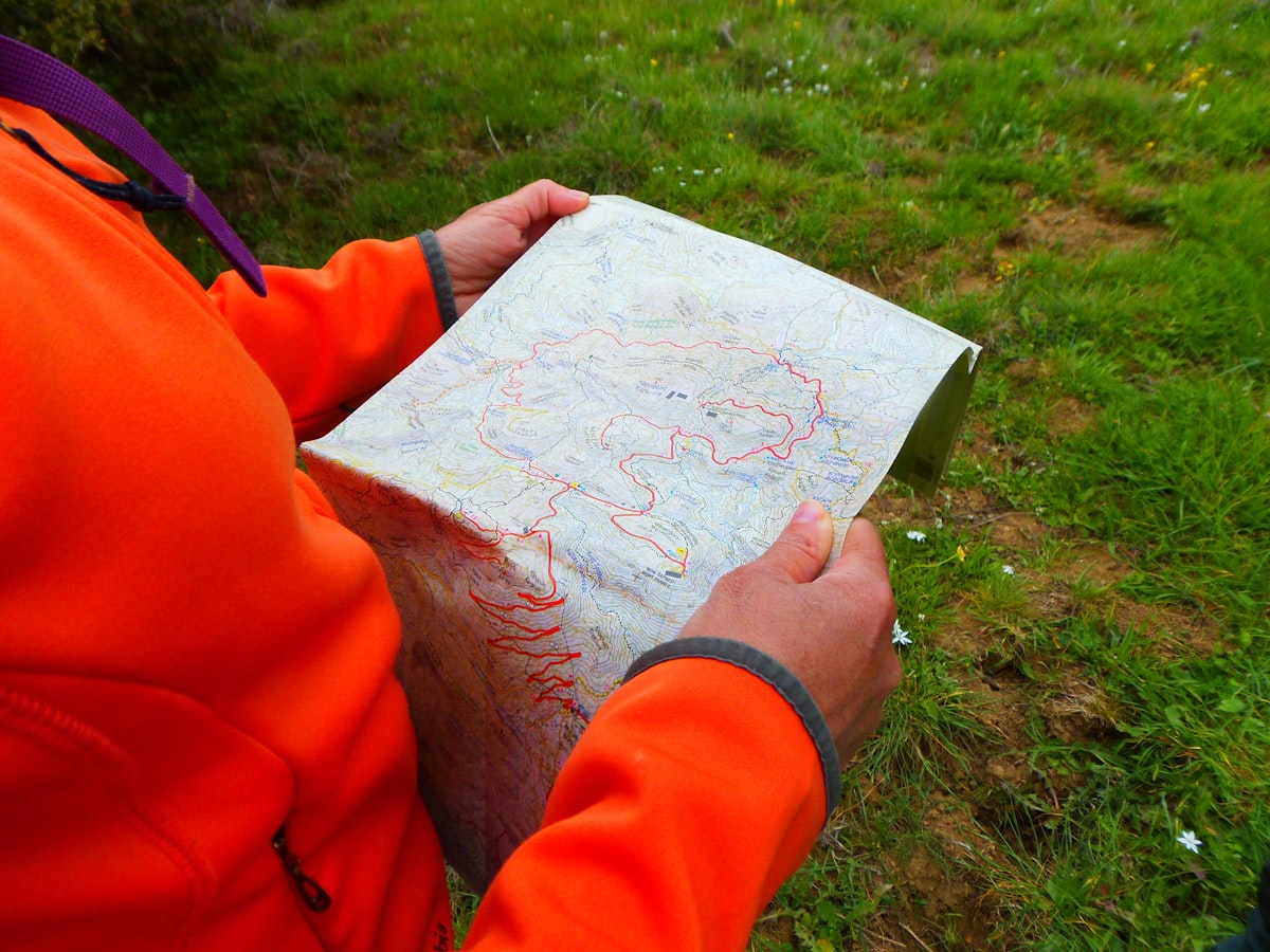
Print a paper topo map with your waypoints as a backup. A dedicated GPS device provides a reliable secondary navigation tool when your phone dies. On your phone, use the offline maps to navigate to your pre-identified locations. Each morning, reference your game plan to decide which area to hunt based on wind direction, weather conditions, and what you learned the previous day. Treat your e-scouted plan as a starting framework, not a rigid script — adapt based on what you find in the field.
Next Step
Check Draw Odds for Your State
Tag-level draw odds across 9 western states — filter by species, unit, weapon, and points. Free to use.
Get the Insider Edge
Join hunters getting exclusive draw odds data, gear deals, and weekly hunt planning tips.
Related Articles

Arizona Elk Calling: September Archery
September archery elk in Arizona means calling. Here's the practical guide to bugles, cow calls, and the timing that produces bulls.

Arizona Hound Hunting Regulations Guide
Arizona hound hunting for bear and lion requires specific permits and tags. Here's the complete regulatory guide for 2026.

Arizona Shed Hunting: Rules & Season Guide
Arizona has specific rules on shed antler collecting. Here's the complete guide to the season, the ethics, and the most productive areas.
No comments yet. Be the first to share your experience!